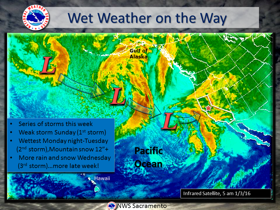
The heaviest storm is expected Tuesday, when up to 2 inches of rain is forecast to drop on the coast and valleys and up to 4 inches could pour onto the mountains and foothills.
Forecasters expect four storms to hit the Southland by Friday, but caution that rain is only a part of the story. Waves up to 10 feet could slam the coast south of Point Concepcion through Tuesday and grow to as big as 15 feet on Thursday.
Here is a rundown of preparations, as compiled by City News Service:
ROAD ALERTS
According to the Los Angeles County Department of Public Works, Lake Hughes Road will close between Warm Springs and Newvale Drive beginning at 4 a.m. Tuesday. Glendora Ridge Road will be closed between Glendora Mountain and Mount Baldy roads beginning at 6 a.m. The roads will reopen "once conditions permit," according to the county. Information on road closures during the storm will be available online at
www.dpw.lacounty.gov/roadclosures or by calling the 211 information line.EVACUATION INFORMATION
According to officials at the Orange County Emergency Operations Center, a voluntary evacuation order will go into effect at 10 a.m. for residences east of 30311 Silverado Canyon Road. The order coincides with a flash flood watch issued by the National Weather Service that will be in effect from 10 a.m. Tuesday until 4 a.m. Thursday. A Red Cross shelter is expected to be established in the area, but details have not yet been released.
WINTER SHELTER
The Los Angeles Homeless Services Authority announced the opening of
seven temporary shelters to augment facilities it already operates. Most of the authority's winter shelters, which are located throughout the county, opened in November and December, with beds for about 2,000 people. The additional seven locations will be able to temporarily house 1,131 people, according to the authority. Information on locations and transportation to reach them is available at
www.lahsa.org or by calling 211.


